|
| *****SWAAG_ID***** | 475 |
| Date Entered | 23/03/2012 |
| Updated on | 24/03/2012 |
| Recorded by | Stephen Eastmead |
| Category | Vernacular Record |
| Record Type | General HER |
| Site Access | Public Access Land |
| Record Date | 21/03/2012 |
| Location | Brownsey Moor |
| Civil Parish | Melbecks |
| Brit. National Grid | SD 97009 98708 |
| Altitude | 417m |
| Record Name | Brownsey House - (Miner/farmer) aka Brownsah or Brownsa House |
| Record Description | Browsey House pre-dates the digging of Brownsey Level which appears to have been driven in the late 1860's.
Christine's Census data pages for Melbecks:
Spensleys of the Yorkshire Dales has this data: Note the house name appears as Brownsah or Brownsa
1841:
Brownsah
SMITHSON John/50/lead miner/Y
SMITHSON Ann/20/Y
SMITHSON John/15/Y
SMITHSON Joseph/12/Y
SMITHSON Mary/11/Y
SMITHSON James/10/Y
SMITHSON Samuel/8/Y
1851:
Brownsah
98. ALDERSON James/head/40/Lead miner/Yks/Melbecks
ALDERSON Ann/wife/30/Yks/Melbecks
ALDERSON George/son/1/Yks/Melbecks
MASON Mary/serv/16/Yks/Muker
1861:
Brownsah House
PARKER James/Head/M/31/Lead miner/Yks/Blades
PARKER Ann/wife/M/27/Lancs/Bacup
PARKER Mary/dau/7/scholar/Yks/Muker
PARKER Thomas/son/5/scholar/Yks/Melbecks
PARKER George/son/3/Yks/Melbecks
PARKER Ann/dau/1/Yks/Melbecks
NEESHAM Edward/Boarder/33/Lead miner/Yks/Muker
NEESHAM Charles/Boarder/9/scholar/Yks/Muker
1871:
Brownsa House
PARKER James/Head/M/42/lead miner/Yks/Aysgarth
PARKER Nanny/wife/M/39/Lancs/Bacup
PARKER Thomas/son/U/15/lead miner/Yks/Muker
PARKER George/son/13/lead miner/Yks/Melbecks
PARKER Elizabeth Ann/dau/9/Yks/Melbecks
PARKER Margaret/dau/7/Yks/Melbecks
PARKER James/son/5/Yks/Melbecks
PARKER J?/son/3/Yks/Melbecks
PARKER Sarah/dau/5m/Yks/Melbecks
1881:
Brownsa
ALDERSON/George/Head/M/32/lead miner/Yks Melbecks
ALDERSON/Ann/wife/M/34//Durham Shotley Bridge
ALDERSON/Margaret/dau//7/scholar/Yks Melbecks
ALDERSON/James/son//5//Yks Melbecks
ALDERSON/Mary/dau//2//Yks Melbecks
1891:
Brownsa - uninhabited
1901 and 1911 Brownsa is not listed.
A Google book search reveals this snippet: A history of Richmond and Swaledale by Raymond Fieldhouse, Bernard Jennings - 1978 - 520 pages - Snippet view:
Services began to be conducted at Blades, and within a few years these first Swaledale Methodists had established a society. Their first meeting place was a room fitted out by William Spencely at 'Brownsey House', near Blades.
|
| Additional Notes | Christine also emailed me this additional information which also dates the house back into the 1770's:
Regarding Brownsey House, I'm pretty sure the other spellings all apply to the same place. My census transcriptions are usually done 'as is' and local dialect would account for the variations in spelling. The same variations appear in the parish registers - as late as 1882 there's a burial of Mary Ann Alderson at Low Row, from Brownsa House.
Grinton reg in 1785 show the burial of Dinah Nicholson of Brownsey, 1779 of Eleanor Rogers of Brownsey, 1772 bapt of Nancy Cleminson of Brownsey, Gunnerside 1871 bapt of Sarah Parker of Brownsea.
I also have a reference to it having been in the occupation of 'Old Willy' Spensley. |
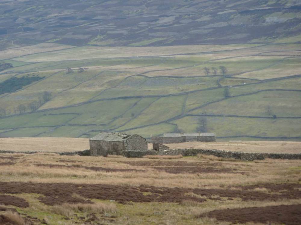
| Image 1 ID | 2374 Click image to enlarge |
| Image 1 Description | Brownsey House from Brownsey Level |  |
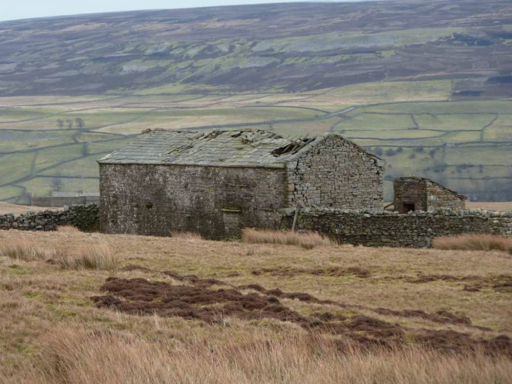
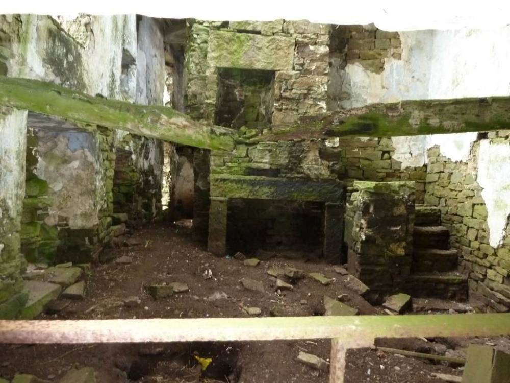
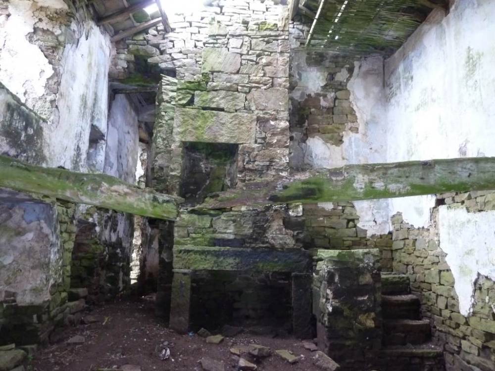
| Image 2 ID | 2375 Click image to enlarge |
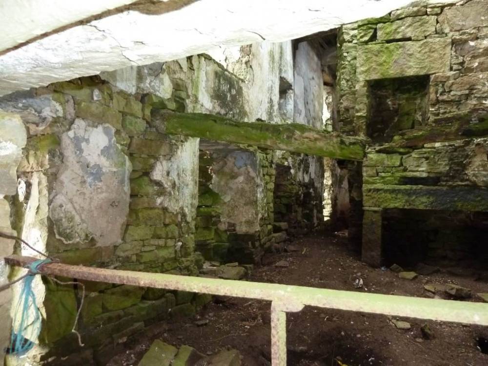
| Image 2 Description | Brownsey House | 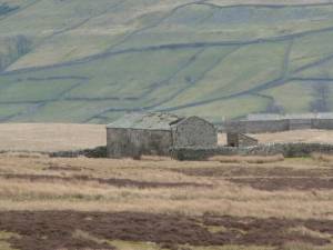 |
| Image 3 ID | 2376 Click image to enlarge |
| Image 3 Description | Brownsey House |  |
| Image 4 ID | 2377 Click image to enlarge |
| Image 4 Description | Brownsey House |  |
| Image 5 ID | 2378 Click image to enlarge |
| Image 5 Description | Brownsey House | 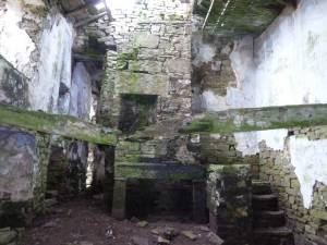 |
| Image 6 ID | 2379 Click image to enlarge |
| Image 6 Description | Brownsey House |  |
| Image 7 ID | 2386 Click image to enlarge |
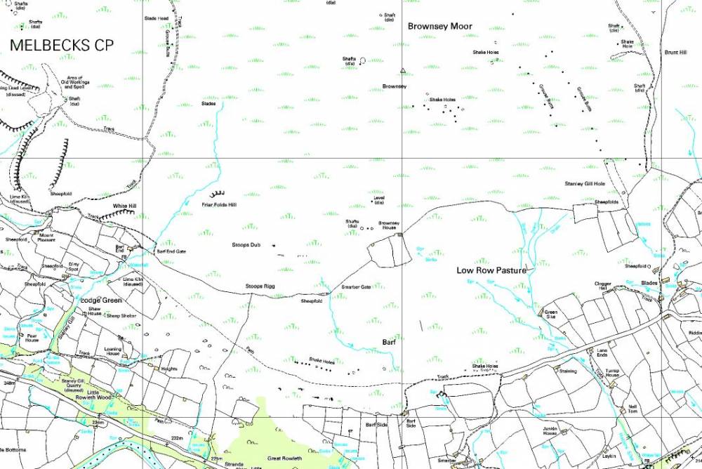
| Image 7 Description | Current 1 in 10,000 OS Map: ©Crown copyright and database rights 2011 Ordnance Survey 1000237401, kindly supplied by the North Yorkshire Dales National Park Authority | 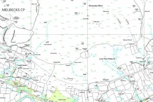 |
| Image 8 ID | 2387 Click image to enlarge |
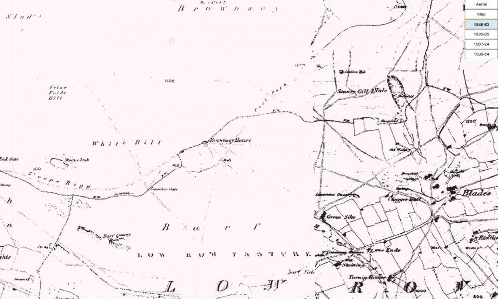
| Image 8 Description | Oldest OS Map pre-dates Brownsey Level (see SWAAG record 473) | 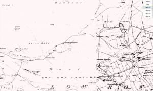 |
| Image 9 ID | 2388 Click image to enlarge |
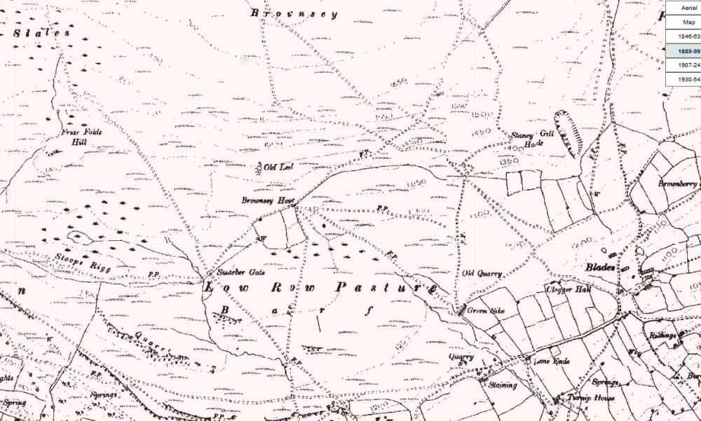
| Image 9 Description | Later OS Map Browsey Level is now present just to the north of Brownsey House | 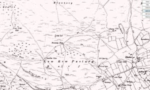 |
| Image 10 ID | 2389 Click image to enlarge |
| Image 10 Description | Later still OS Map | 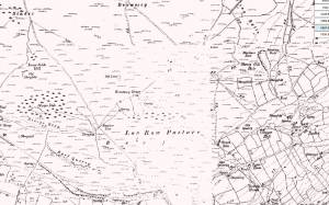 |
| Image 11 ID | 2390 Click image to enlarge |
| Image 11 Description | Browsey House - Mick Borroff | 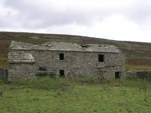 |